Civic Media
  • News

  • Shows

  • Stations
    • Radio Stations

    • Coverage Area

  • About
    • Get to Know us

    • Our mission, vision, values

    • Careers

    • Get in Touch

    • Press

    • Awards

  • Advertise

  • Support

  • Store

Civic Media

202 State St, Suite 200
Madison, WI 53703
608-819-8255
info@civicmedia.us

News Ethics and Standards | Privacy Policy

Youtube

Bluesky

X

Facebook

Instagram

LinkedIn

  • News

  • Shows

  • Stations
    • Radio Stations

    • Coverage Area

  • About
    • Get to Know us

    • Our mission, vision, values

    • Careers

    • Get in Touch

    • Press

    • Awards

  • Advertise

  • Support

  • Store

© 2026 Civic Media

WMDX

92.7 WMDX

Select to listen

0:00

WMDX

Something went wrong...

Winter seeks one last revenge this weekend

Weather

•

1 min read

Winter seeks one last revenge this weekend

John Scott's profile picture
John Scott

Mar 13, 2026, 9:25 AM CST

Facebook
Instagram
Twitter
Reddit
Bluesky

Share

Facebook
Instagram
Twitter
Reddit
Bluesky

(Photo by Darren Hauck/Getty Images)

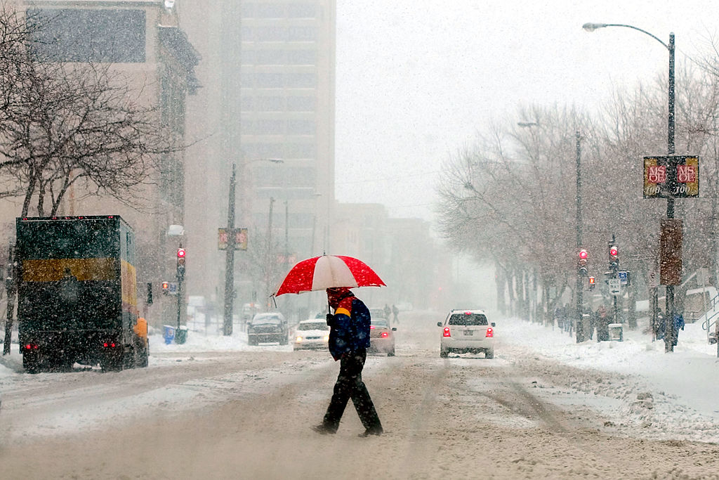
Turbulent winter weather is headed our way, expeccted to bring varying amounts of snow, sleet, and howling winds to Wisconsin today into Monday, according to the National Weather Service.

The first of two anticipated weekend storms is proceeding as expected across northern Wisconsin. Radar imagery indicates the position of the low-pressure system is responsible for both the elevated wind speeds and deteriorating road conditions. Travel is expected to be unpleasant north of a line from Green Bay to Minneapolis. Motorists in this area are strongly encouraged to allow additional travel time today.

The second storm system is also tracking as expected. A Winter Storm Watch remains in effect from 7:00 PM tomorrow through 4:00 PM Monday — a 45-hour period of hazardous conditions. This system presents a particularly complex forecasting challenge due to anticipated transitions in precipitation type and the uncertainty surrounding their timing. Sharp, localized boundaries are expected between areas experiencing freezing rain, rain, sleet, and snow.

Wisconsinites are strongly advised to avoid travel on Sunday. Any improvement in conditions later in the day should be considered favorable but not anticipated. Completing necessary travel and errands by Saturday evening is highly recommended.


See more from the National Weather Service here.

John Scott
John Scott

John is a seasoned media and marketing executive with experience programming and promoting iconic radio brands in some of the nation’s most competitive markets, including New York City, Boston, Memphis, Dallas, and San Francisco. He has taught graduate-level courses in branding and marketing at the country’s largest private art and design school and has held business development and marketing roles at multiple technology startups.  Reach him at john.scott@civicmedia.us.

More from John Scott

Wisconsonites plead for release of dogs at Blue Mounds breeder

East High Video Feature Wins Statewide Journalism Honor

Want More Local News?

We've got you. Scan it to get it.

Civic Media App Icon

Civic Media

Civic Media Inc.

Civic Media App Icon

The Civic Media App

Put us in your pocket.